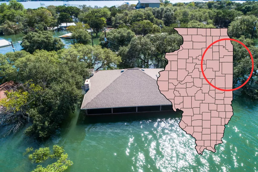
Significant Portions of Illinois Could Be Underwater in Near Future (MAP)
New data from the National Oceanic and Atmospheric Administration (NOAA) revealed how significant portions of Illinois, namely the Chicago area, could be swallowed up by rising lake levels in the near future.
The NOAA went as far as to create an interactive map of the state that shows just how widespread and severe flooding could be. The map was created using the most advanced regional climate modeling system, and looked at the water-level rise of the Great Lakes, specifically Lake Superior, Michigan, Huron, and Eerie.
Obviously, when it comes to Illinois, Lake Michigan is the lake to watch. Anyone who has lived/around Chicago knows the impact of the lake, be it on winds, wind chills, snow, and more.
Per Newsweek, one of the major outlets to report on the creation of this NOAA map, more than 30 million people live along the Great Lakes' roughly 4,500 miles of coastline. The coastline stretches across the United States and Canada, with impact on major metropolitans like Chicago, Detroit, and Buffalo.
Research conducted by the Michigan Technological University in 2022 revealed that over the past several decades, the Great Lakes have experienced significant fluctuations in water levels, sometimes a change of six feet. The university said these changes were due to climate-induced alterations to three major areas: over-lake precipitation, lake evaporation, and basin-runoff.
Here's a look at the NOAA's predictive map of Chicago:
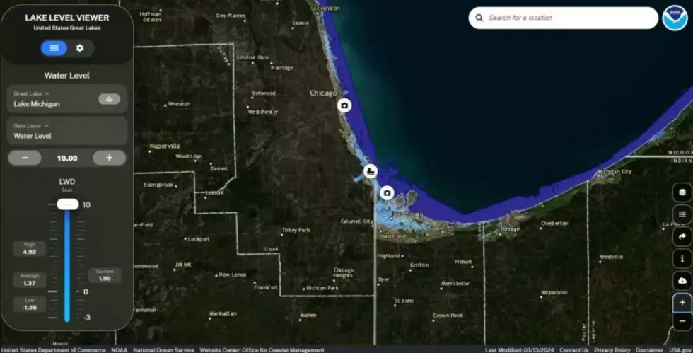
As you can see from the map, much of the impact is relegated to South Chicago, along with the east side of the city. The water from Lake Michigan would engulf entire neighborhoods, including the Chicago Bureau of Sanitation on Ferdinand Street.
Like sea level rise, higher lake levels can increase coastal erosion, change navigation considerations and increase the risk of coastal flooding. - American Geophysical Union (AGU) in June 2022, per Newsweek
Probably the scariest part of this data is that there is no clear-cut way we as individuals can prevent it. It's as if we can only try to mitigate our own circumstances and our lives in the process. This is the result of sea level rise over the course of decades, and the impact would be catastrophic. Everything from disruptions to commutes and commerce to the flooding of neighborhoods to wide-ranging upgrades to public works and waste systems would be necessary in this situation.

Read more about NOAA's new map of Chicago showing treacherous lake level rise on Newsweek's website.
TIPS: Here's how you can prepare for power outages
LOOK: The most expensive weather and climate disasters in recent decades
Gallery Credit: KATELYN LEBOFF
More From Y105